 Download
Are you looking for an easy way to manage your KML/KMZ/GPX files? Do you need a robust GIS tool for measuring distances, GPS logging, and accessing WMS data? Look no further than Mapinr. This app is designed to simplify your mapping needs, providing an efficient and user-friendly experience. Plus, you can download offline maps for those adventures where internet access is limited.
At Mapinr, we understand the challenges posed by the rapid evolution of Android versions. As a non-profit project, keeping up is tough, but we're committed to maintaining a secure, privacy-friendly, and affordable app. We acknowledge that Google's minimum Android version requirement can be a hurdle for many users. That's why we provide downloads for older Android versions (below Android 14) on our website, ensuring broader accessibility.
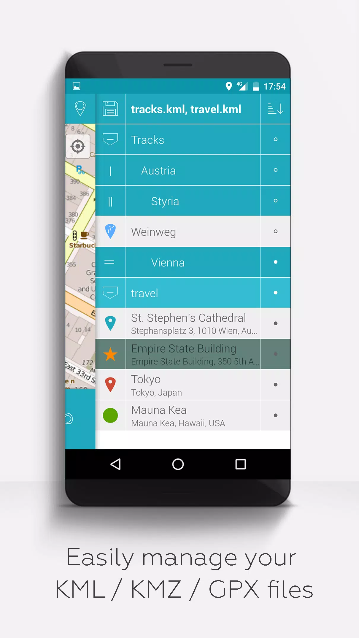
Do you want to view and manage your own points of interest or perhaps add your pictures to a map? MAPinr is the perfect tool for you. This simple, ad-free Android app enables you to manage your kml/kmz files and display your gpx files on various maps. Whether for professional use or leisure activities like hiking, cycling, running, or skiing, MAPinr has you covered.
We value your feedback and are eager to improve MAPinr. Please share your problems and ideas with us at [email protected]. We appreciate constructive criticism and understand that software bugs can be frustrating. We ask for your patience as our limited resources mean we can't implement every suggestion immediately.
MAPinr offers a comprehensive set of features:
- Ad-free Experience: No ads to distract you from your mapping tasks.
- Organized File Management: Use a hierarchical folder structure to manage multiple kml/kmz/gpx files.
- Full KML/KMZ Control: Create, load, edit, save, import, export, and share kml/kmz files.
- Waypoint, Line/Track, and Polygon Management: Create, load, edit, save, import, export, and share these elements.
- Photomaps: Add pictures to your waypoints to create personalized photomaps.
- Versatile Map Display: Show waypoints, lines/tracks, and polygons on various maps including Maps, Satellite, Hybrid, OpenStreetMap, Opentopomap, and Opencyclemap.
- Coordinate Sharing: Easily share the coordinates of your waypoints.
- Custom Colorization: Individually colorize waypoints, lines/tracks, and polygons for better visualization.
- Interoperability: Open exported kml/kmz files in other apps.
- Advanced Search: Search by name, address, and coordinates.
- Location Sharing: Share your location with friends.
- Multi-File Display: Display multiple kml/kmz/gpx files simultaneously.
- File Merging: Merge kml/kmz files for streamlined management.
- Cloud Integration: Seamlessly integrate with cloud services.
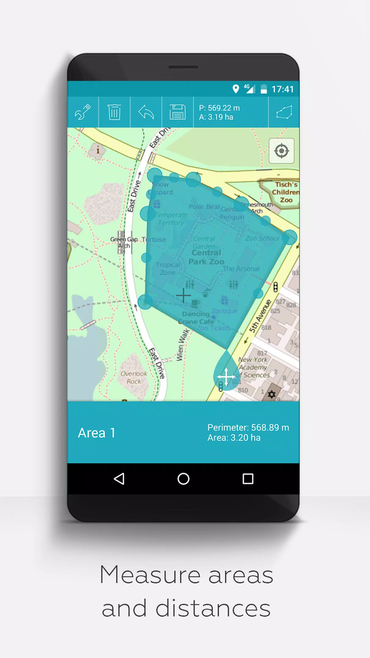
- Measurement Tools: Measure distances and areas directly on your map.
- Multilingual Support: Currently available in English, Spanish, Lithuanian, and Polish.
Extended features are available for free with donations or a LinkedIn like, and can be activated in the app's settings:
- Offline Maps: Download OpenStreetMap for offline use.
- GPX Viewer: Display GPX files.
- Web Map Service (WMS): Access and display arbitrary map data, such as Opendata from www.data.gov.
- Custom Metadata: Create custom metadata for your maps.
- Custom Icons: Upload and use your own icons.
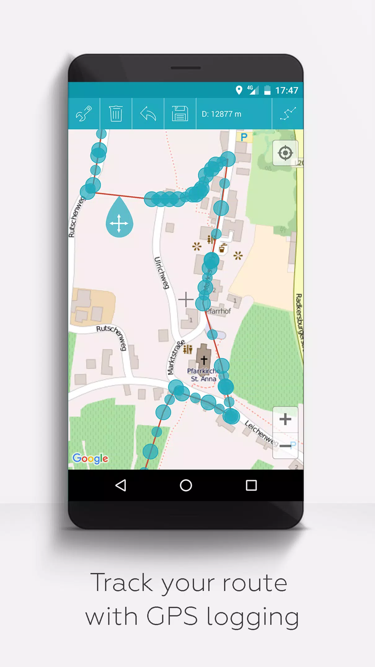
- GPS Logging: Record your GPS tracks.
Unlike other apps, MAPinr respects your privacy and does not collect or sell your data. Donations are a voluntary contribution to support our non-profit efforts. Thank you for choosing Mapinr for your mapping needs.