 Download
Stay on top of severe weather with Zoom Earth, the ultimate interactive weather map and real-time hurricane tracker. Whether it's hurricanes, typhoons, or tropical cyclones, Zoom Earth provides comprehensive tracking tools to keep you informed and safe. Dive into a wealth of features designed to enhance your understanding of global weather patterns, from satellite imagery to rain radar and beyond.
[Key Features]
Satellite Imagery: Experience the world's weather through near real-time satellite imagery provided by NOAA GOES, JMA Himawari, EUMETSAT Meteosat, and NASA's polar-orbiting satellites Aqua and Terra. This feature ensures you have the latest visuals to monitor weather developments.
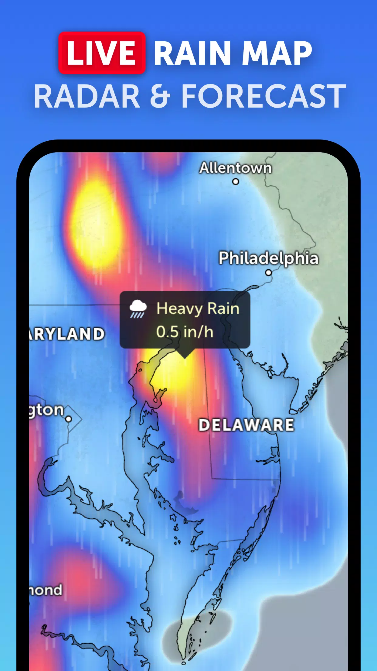
Rain Radar: Be proactive with our weather radar map that displays rain and snow in real-time, detected by ground-based Doppler radar. This tool is essential for staying ahead of storms and planning your activities accordingly.
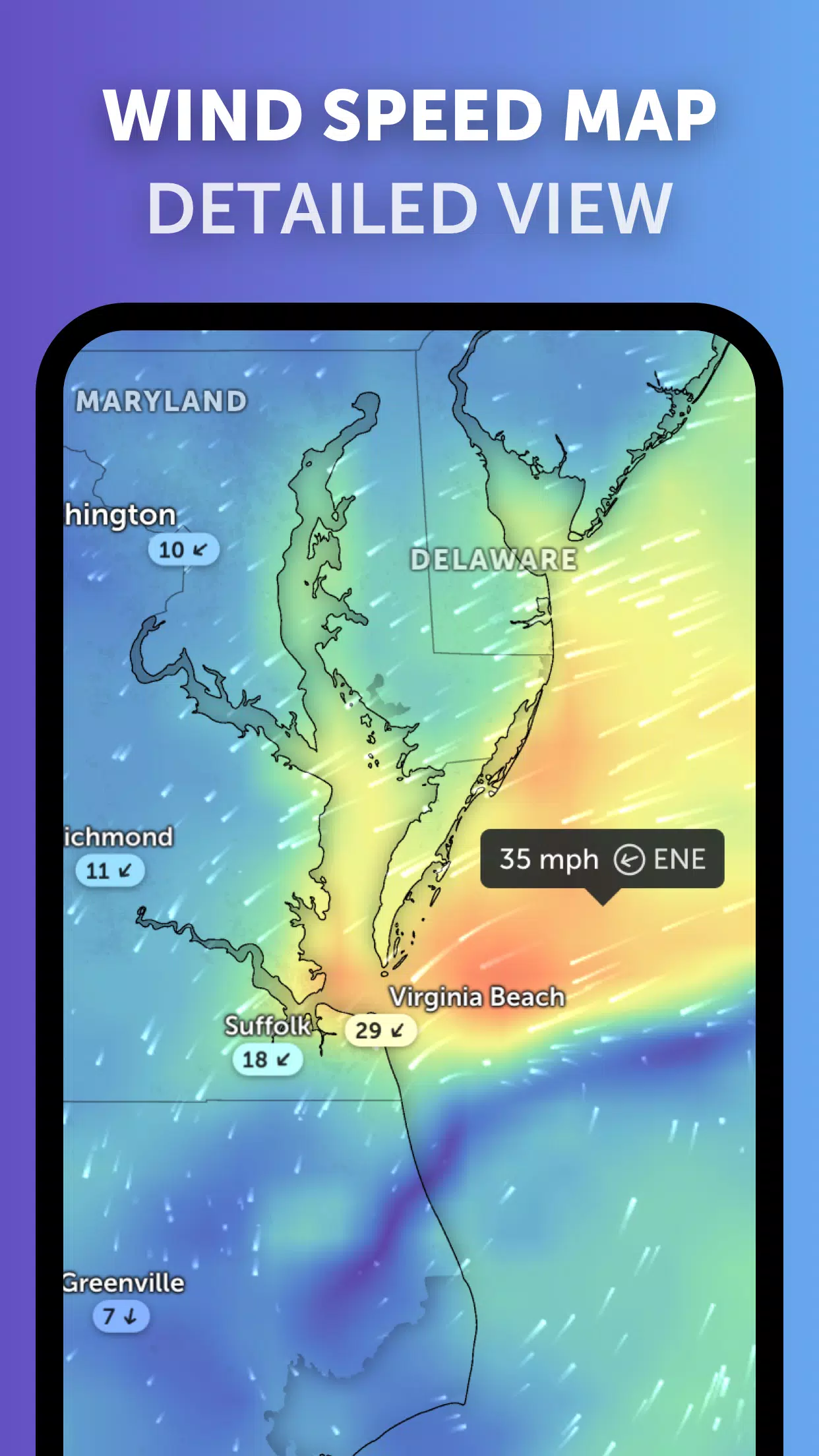
Weather Forecast Maps: Explore visually stunning and interactive global forecast maps. These maps provide detailed insights into precipitation, wind speed and gusts, temperature, "feels like" temperature, relative humidity, dew point, and atmospheric pressure, helping you prepare for any weather condition.
Hurricane Tracking: Track the progression of hurricanes from their initial development to category 5 status in real-time. Our advanced tropical tracking system utilizes the latest data from the National Hurricane Center (NHC), Joint Typhoon Warning Center (JTWC), Naval Research Laboratory (NRL), and the International Best Track Archive for Climate Stewardship (IBTrACS) to ensure you have the most accurate information at your fingertips.
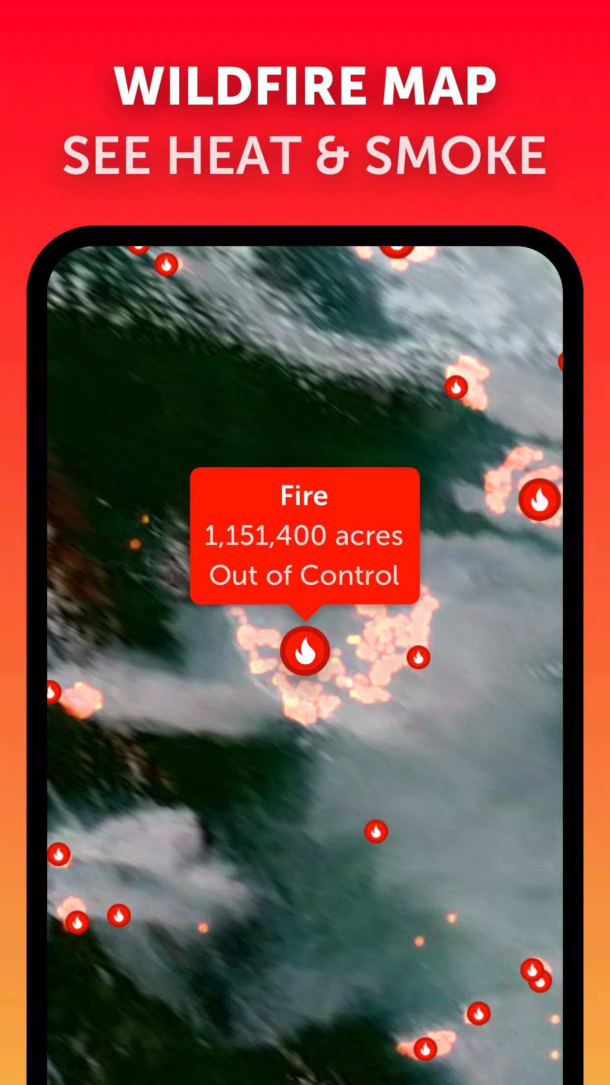
Wildfire Tracking: Keep an eye on wildfires with our active fires and heat spots overlay, which displays points of extremely high temperatures detected by satellites. This feature is updated daily with data from NASA's Fire Information for Resource Management System (FIRMS), offering crucial information for fire-prone areas.
Customization: Tailor your experience with our comprehensive settings. Adjust temperature units, wind units, time zone, animation styles, and more to suit your preferences and enhance your weather monitoring experience.
What's New in the Latest Version 3.1
Last updated on Sep 19, 2024
- Enhanced user experience with reduced clutter when viewing multiple tropical systems.
- Improved alert system with separate notifications for Atlantic and Eastern Pacific systems.
- Refined map labels for clearer and more accurate information display.